


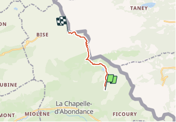

5,1 km | 11,9 km-effort


Benutzer


Kostenlosegpshiking-Anwendung
 SityTrail
IGN / Geografische Institute
SityTrail World
Die Welt öffnet sich für Sie
Tour Zu Fuß von 5,7 km verfügbar auf Auvergne-Rhone-Alpen, Hochsavoyen, La Chapelle-d'Abondance. Diese Tour wird von RAY25 vorgeschlagen.
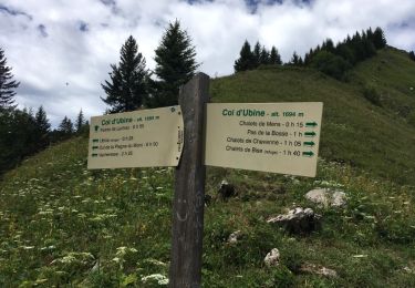
Monter en voiture depuis Chapelle en direction de Ryz. Continuer jusqu'au parking sous la ferme de Sevan-Devant (1595m)

Wandern

Wandern

Wandern

Zu Fuß

Schneeschuhwandern
Wandern

Wandern

Wandern
Wandern